TopNET Live Alaska
Access a Real-Time GNSS Reference Network in Alaska
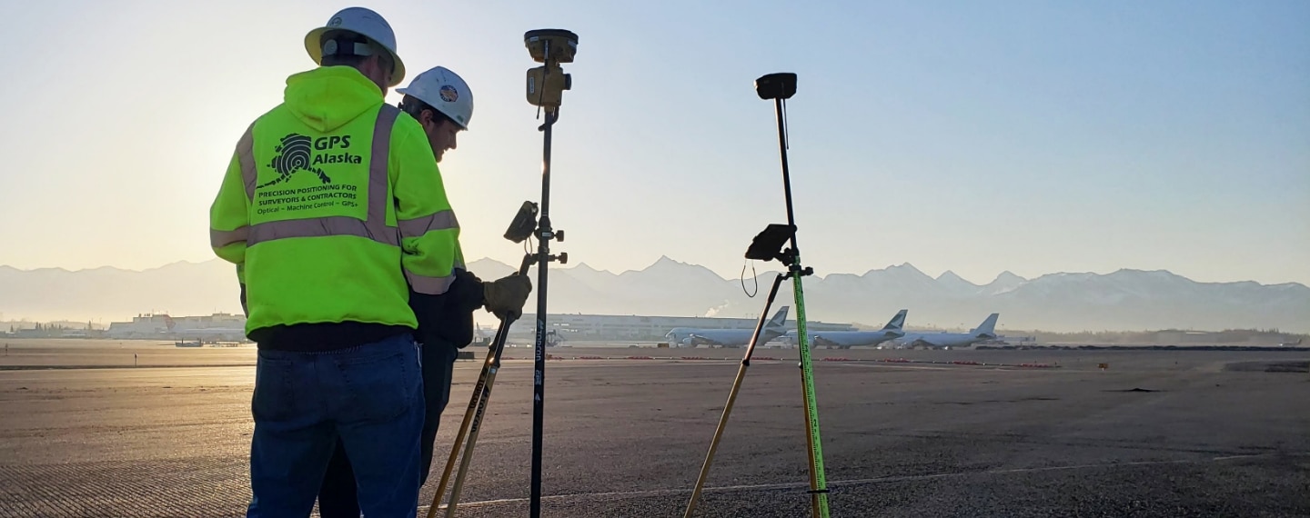
Ensure the Most Accurate GNSS Positioning With TopNET Live Alaska
TopNET Live Alaska is a subscription-based, real-time GNSS Referencing Network delivering high-accuracy Network RTK correction data. TopNet Live Alaska utilizes a cellular data connection to provide access to the Network RTK GNSS corrections — allowing operators to bypass a field base station setup. Unlike Virtual Reference Station networks, the operator can switch between network solutions or a single baseline solution, eliminating modeling errors at close distances. This network is fully interoperable with all makes of network capable receivers for surveying, construction, and GIS mapping throughout Alaska.
TopNET FAQs
What is TopNET Live Alaska?
TopNET Live Alaska is a subscription based RTK service, delivering high quality modeled GNSS corrections to all users working inside the network boundary. A variety of applications can use the service, such as, land surveying, construction, cadastre, machine control, GIS, and much more.
How much does a TopNET Live Alaska subscription cost?
TopNET Live Alaska is designed to meet the unique needs of our customers by providing a wide range of subscriptions services. Network RTK (modeled solution), RTK, and DGPS can be utilized on an annual, biannual, and hourly basis. For more information and pricing, please call (907) 562-8000.
How do I know if I can use Network RTK on my equipment?
GNSS Rovers have the standard NTRIP protocol embedded in their software. This acts as a switchboard for GNSS Network RTK services that enable you to connect with your subscription user ID and password. To connect to the Network via NTRIP, you need to have a mobile internet connection. Internal cellular modems are usually supplied as an option with your equipment. Cellular modems can be utilized by the field controller or the receiver to gain access to TopNET Live Alaska. If your equipment does not have a internal modem, your cellular phone can be used as a hot spot to gain access to TopNET Live Alaska.
What Network RTK formats does TopNET Live Alaska Support?
Virtual Reference Stations is the most common Network RTK product and TopNET Live Alaska can cater to a variety of data formats, such as;
- RTCM 3.x
- RTCM 2.x
- CMR
- CMR+
I have a GNSS Rover from another manufacturer; can I still use TopNET Live Alaska?
Yes, TopNET Live Alaska is interoperable with other manufacturers’ rovers. We would recommend using the RTCM 3.x format, as this is standardized between manufacturers.
What accuracy can I expect from the TopNET Live Alaska service?
Typically, TopNET Live Alaska Network RTK solutions provide rms (root mean square) accuracies of 1-2 cm in plan (x,y) and 2-3 cm in height (z).
Is there a DGPS/DGNSS service?
Yes, DGPS or DGNSS subscriptions are also available in all the common formats.
Can I try before I buy?
Yes, TopNET Live Alaska is offering trial licenses. For additional information give us a call at (907) 562-8000.

Sign Up for a Free Trial
"*" indicates required fields