No matter your role in the survey or construction industry, precision is key to achieving performance and providing quality work on any job. And here in Alaska, lack of precision on a job can cost you thousands of dollars at a minimum.
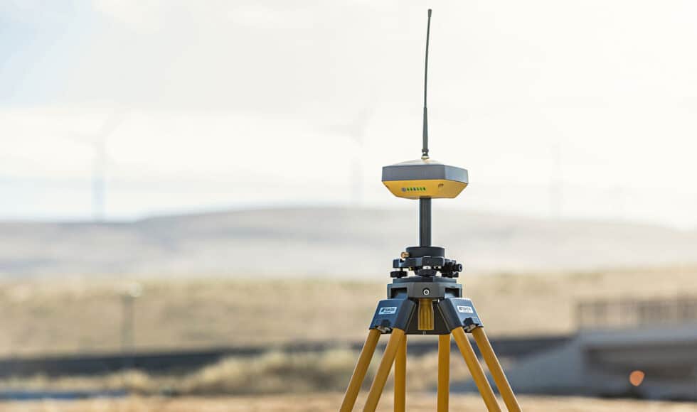
When it comes to acquiring precise position, you need to have the right tools – especially while out surveying for a project. This is where a real-time GNSS correction data solution can prove to be invaluable, as it is through correction data that you can home in on a location and get accuracy within a golf ball sized radius.
But what exactly is an RTK Network, how does an RTK Network work, and how can it help you on the job? We’ll get right to the details and give you an in-depth understanding of how this essential technology works.
Could your crew benefit from the use of real-time GNSS correction data out in Alaska? Reach out to GPS Alaska for more information on how to access TopNET Live.
What is the Value of a Cellular RTK Network?
When it comes to adding value to your construction or survey project, having reliable correction data cannot be overstated. After all, you need to know where you’re at in relation to the project. And if you get it wrong, you could be throwing thousands of dollars away each day.
For example, in a traditional RTK survey, there is up to a 10-kilometer range between the base station and a rover. Essentially, the correction data the base station sends the rover becomes inaccurate the further away the rover moves from the base station, especially outside of the 10-kilometer range. As such, this has always been a challenge in construction or surveying jobs that encompass an area greater than 10 kilometers.
On a large-scale construction or surveying job out in Alaska, the only way to keep correction data accurate is to set up multiple base stations throughout the project, or move the base station accordingly for the scope of the project. The problem is, each time a base is set up or moved the H.I. (Height of Instrument) will change, which adds the possibility of human-induced error.
A few problems that may occur on large-scale projects with inadequate tools are:
- Losing time on a project
- Losing money on a project
- Getting an inaccurate survey
- Having to remove structures built according to inaccurate data
- Having to operate within a 10-kilometer range only
With access to a network RTK correction service, such as TopNET Live Alaska, your correction data can be received from base stations already set up across Alaska – and operate with traditional RTK accuracy, as long as the project falls in the network RTK coverage area.
TopNET Live Alaska
TopNET Live Alaska is a real-time GNSS referencing network that is capable of delivering Network RTK correction data. This subscription-based service utilizes cellular data connections and provides your team with access to the Network RTK GNSS corrections. And this allows your team to operate on a large-scale project without having to set up an onsite base station.
Additionally, unlike virtual reference station networks, your team will have the ability to toggle between single baseline solutions or network solutions. And this is essential for eliminating modeling errors at closer distances. Another great feature is that this network is completely usable with all types of network-capable GNSS receivers – making construction, surveying, and GIS mapping throughout Alaska a much more streamlined and user-friendly process.
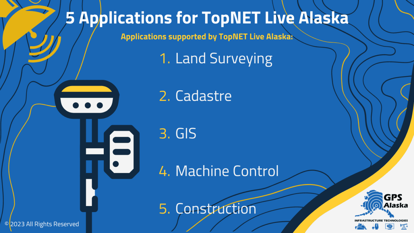
A few applications that TopNET Live Alaska can support are:
- Land Surveying
- Cadastre
- GIS
- Machine Control
- Construction
According to Michael Williams of GPS Alaksa, TopNET Live Alaska Network base stations are not only reading the satellites signals, the data collected is also used to map the atmosphere in order to see in real-time what the inaccuracies are when determining location data. After this, the aggregate of essential data is fed into a software application to produce a correction that a rover will use to determine its precise location.
For example, if a rover is out in Anchorage without a base station, the rover can connect to a TopNET Live base station through a cellular connection and receive real-time correction data. And this tech is invaluable because a crew no longer has to set up multiple base stations (which can cost thousands of dollars) or move them accordingly as the project evolves.
How Can Network RTK Solutions Benefit Surveyors in Alaska?
Anyone who knows Alaskan terrain understands that line-of-sight isn’t always available for traditional surveying methods. And with the limitations that UHF radio has, network corrections are the obvious solution to challenges that all surveyors face when out on the job in Alaska.
The main benefit for surveyors using Network RTK corrections is that it can save both time and money. Because for example, setting up a base station two miles away from the rover may have limitations that UHF radio cannot surmount between the rover and the base station – such as operating on the opposite side of a mountain from your base station.
With a network correction, as long as you have Internet access through a cellular device, and the project is inside the network coverage area, you’ll be able to get a correction through the network – and this can be a total game changer for productivity in both surveying and many other forms of construction and contract work.
The Future of RTK Networks
Currently, TopNET Live Alaska base stations are set up in several major regions and villages in Alaska, including places like Nome and Barrow – with more to come in the future. Though the far remote regions have not yet been added to the network, expansion is likely inevitable with the ramping up of construction projects in Alaska.
RTK networks not only offer those operating in Alaska the convenience of receiving correction data through cellular applications, they also mitigates the need for purchasing multiple base stations which can cost anywhere from 13k to 22k on average.
GPS Alaska, through a partnership with TOPCON, is also working toward setting up base stations in remote villages to increase coverage of TopNET Live Alaska. And once cellular data becomes available in these regions, the network will be able to provide access to correction data for surveyors and contractors operating in more rural or sparsely populated regions.
It’s only a matter of time before the majority of Alaska is covered under the TopNET Live Alaska umbrella. And this is sure to open up many doors for major construction and development projects across the great state of Alaska
Could your construction crew benefit from the use of RTK Network correction data out in Alaska? Contact GPS Alaska for more information on how to access TopNET Live.