Alaska is a tough place to live and work. With an extreme landscape and a climate that can shift before you even realize it, you have to know the terrain and understand the dynamics of Alaskan life if you’re going to make it out here – especially when you’re out on a remote job in the arctic.
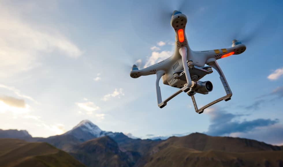
For anyone surveying out in the remote regions of Alaska, the job itself is as tough as the terrain. After all, this is a landscape where line of sight is hard to come by. And even with a Total Station system, you’re still likely walking miles to get to a specific vantage point. This is where a drone for land surveying can be a total game changer.
You might be wondering what the benefits of drone surveying are, or what your overall ROI for drone surveying equipment in Alaska might be. The good news – you can save a ton of money (and time) by utilizing a drone for land surveying. And in the following, we’ll cover everything you need to know.
Could you benefit from using a drone for land surveying in Alaska? Contact GPS Alaska today to check out your options.
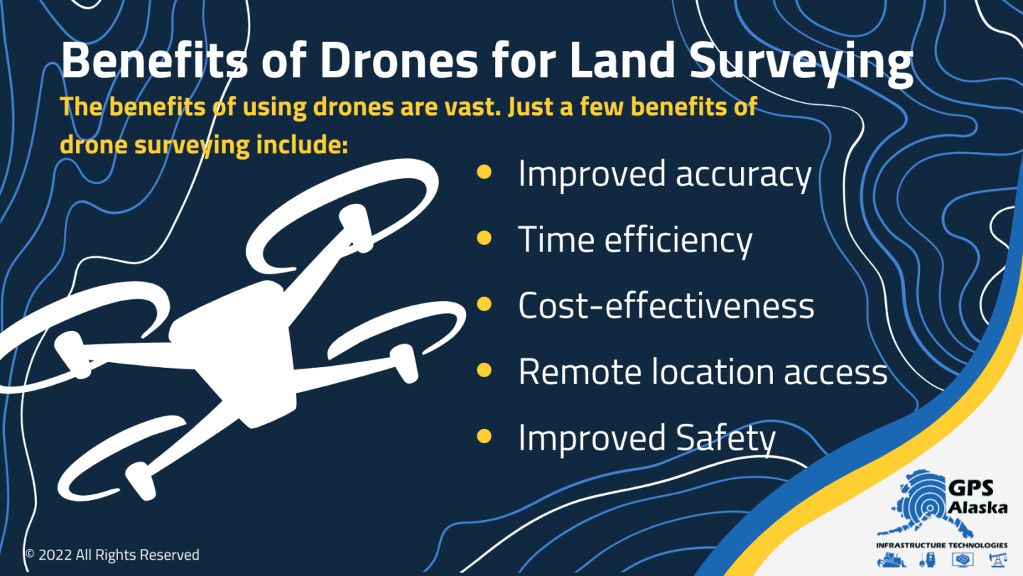
Benefits of Drones for Land Surveying
Alaska has some tough terrain for even the most seasoned surveyors working in the field. And if you ask any fellow surveyor, they’ll likely tell you that they’ll take any extra help they can get on the job. Fortunately, drones offer just the help that you need.
From improved time management and productivity to versatility and making the job easier in general, drone surveying has many benefits. Just a few benefits of drone surveying include:
- Improved accuracy
- Time efficiency
- Cost-effectiveness
- Remote location access
- Improved Safety
Accuracy
With advances and improvements in unmanned aerial vehicles (UAVs) and with digital camera technology in recent years, most drones today can now use cameras capable of taking images and video with up to or over 5.2k resolution – and this brings the forms and boundaries you’re looking for into full view.
In addition, the latest camera stabilization mechanisms enable drones to capture high-resolution images even in extreme and inclement weather conditions. And out here in the arctic where the weather can change by the minute, this is a feature that will pay for itself.
Time Efficiency
Compared to the traditional methods where it may take a crew of surveyors over 3,000 man-hours to complete a big job, drones can cover more ground in less than half that time.
Drones can cover the land as the crow flies while producing high-resolution images and video recordings all in a matter of a few hours. And as flight paths can be pre-planned and modified as needed quickly, this also saves a significant amount of time on the overall project length – saving you hours of labor.
Cost-Effectiveness
Other aerial survey methods in the past have included using helicopters and other light aircraft to cover hard-to-reach areas. But these methods are often much more expensive and are drastically affected by inclement weather.
The fact that drones are only a fraction of the cost of chartering a helicopter or an aircraft plus fuel and pilot flight time can save you thousands of dollars alone on just a single project, no matter how big in size or scope.
Remote Location Access
We all know how the remote, rugged terrain in Alaska can make any job extremely challenging. But drones can easily access remote locations at an impressive range – keeping you and your crew safe from dangerous landscapes and wildlife.
Additionally, the only downtime required for a drone includes necessary maintenance and recharging fuel cells.
Improved Safety
Where aerial surveys are required, you and your crew may need to transport and operate heavy equipment at extreme heights, or in dangerous and rugged terrain. Using drones in these conditions removes the safety risk for you and your crew – keeping everyone safe on the ground waiting for the drone to do its job.
Overall, using drones reduces the risk of accident and injury, and mitigates downtime if you or a crew member becomes injured while out on a job.
The High ROI of Drones for Land Surveys
All in all, it’s been estimated that drones can cut the overall cost of a survey project by as much as 85 to 90 percent. And if you know your numbers, this is a huge benefit to any construction or surveying project.
Just as an example, West Virginia’s Department of Transportation estimated that by using drone technology, labor can be reduced by as much as 90 percent. This means that a mapping project that takes up to two weeks to complete requiring a surveying crew of 40 members would correspondingly require approximately 3,200 man-hours. With drone technology, the same job can be done by a crew of 7 people in just one week totaling around 240 man-hours.
What Drone Models are Best for Surveying?
Where drones for land surveying can really cut costs and put money back in your pocket in time and labor. And here at GPS Alaska, we have options that you’ll want
Drones and UAVs enable you and your crew to save money and gather data more efficiently and safely. And if cutting the cost of surveying jobs as much as 90 percent wasn’t enough, check out the models we offer that can simplify your job and increase productivity:
- Phantom 4 RTK – This drone is equipped with an RTK module that uses OcuSync, an advanced TimeSync system, along with an onboard one-inch CMOS sensor
- WingtraOne – This mapping drone is perfect for large-scale surveys and can fly at speeds of 36mph, and it’s equipped with an onboard PPK GNSS receiver along with a 42-megapixel camera
- AeroPoints™ – This ground points control system is the perfect solution for drone mapping and allows any operator to quickly and precisely establish ground control and receive fully automated corrections
No matter if you’re carrying out topographic and land surveys, quarry surveys, or any type of mapping project out here in Alaska, you need the right tools that get the job done accurately the first time. And when you can spend less money and get the job done faster, you know you’ve been paired with the right equipment.
The bottom line is, drones allow for easy access in hard-to-reach or even dangerous locations. And you can map miles of space using a drone. In Alaska, this is a Herculean feat. But perhaps the best element of using a drone for land surveying in Alaska is the fact that you’ll be able to get an extreme ROI – near 90 percent ROI in some cases.
When you’re working out in Alaska, the right tools can make all the difference in how challenging the job is. And with drones on your team, you’ll be able to get those remote jobs in the arctic done in a fraction of the time that it would take you using traditional methods.
Could your surveying crew benefit from using a drone for land surveying in Alaska? Contact GPS Alaska today to learn about your options.