GPS Alaska
  • Home
  • Training & Updates
    • Training >
      • Veta Intelligent Compaction
      • MAGNET
      • Pocket 3D
    • Important Updates >
      • New Topcon Training and Support Site
      • MAGNET Version 4.0 Release
      • MAGNET Version 3.3 Release
      • MAGNET Version 3.2.1 Patch Release
      • MAGNET Version 3.2 Release
    • Testimonials
  • Contact
    • Location
    • Staff
  • Construction
    • Machine Automation
    • GPS Surveying Systems >
      • Recievers >
        • NEW HiPer HR
        • GR-5
        • HiPer SR
        • HiPer V
        • Hybrid Positioning
      • Antennas >
        • PG-S1
        • PL-S1
        • CR-G5
        • PN-A5
      • Radios >
        • SRL-35
        • SATTELLINE - EASy Pro
        • ADL Vantage 35
    • Field Controllers >
      • FC-5000
      • Tesla
      • FC-2600
      • FC-500
      • Allegro 2
      • Surveyor 2
    • Lasers, Levels & Theodolites >
      • General Construction Lasers >
        • RL-H4C
        • RL-VH4DR
        • RL-SV2S
      • Interior Lasers >
        • RL-VH4DR
      • Slope Lasers >
        • RL-200
        • RL-SV2S
      • Utility Lasers >
        • TP-L Series
      • Auto Levels >
        • DL Series
        • AT-B Series
      • Theodolites >
        • DT-200
    • Scales >
      • Wheel Loader Scale
      • Dumper Scale
      • Excavator Scale
      • Hook-Lift Truck Scale
      • Conveyor Belt Scale
      • Software Solutions
    • Return On Investment
  • Survey
    • GPS Surveying Systems >
      • Recievers >
        • NEW HiPer HR
        • GR-5
        • HiPer SR
        • HiPer V
        • Hybrid Positioning
      • Antennas >
        • PG-S1
        • PL-S1
        • CR-G5
        • PN-A5
      • Radios >
        • SRL-35
        • SATELLINE - EASy Pro
        • ADL Vantage 35
    • Field Controllers >
      • FC-5000
      • Tesla
      • FC-2600
      • FC-500
      • Allegro 2
      • Surveyor 2
    • Levels >
      • DL Series
      • AT-B Series
    • Total Stations & Theodolites >
      • NEW GT Series
      • PS Series
      • LN-100
      • IS-3 Series
      • DS Series
      • MS Series
      • Hybrid Positioning
      • OS Series
      • ES Series
      • GPT-3500
      • DT-200
  • Software
    • Construction Software >
      • Construction Field Software >
        • Pocket 3D
        • MAGNET Field Site
        • MAGNET Field Layout
        • TopNET Live
      • Construction Design & Planning >
        • DynaRoad
        • MAGNET Office Mass Haul
        • MAGNET Office Takeoff
        • MAGNET Office Site
        • MAGNET Office Site With Resurfacing
        • 3D Office
        • TopNET Live
      • Construction Management Software >
        • DynaRoad
        • SiteLink 3D
        • SiteLink 3D Enterprise
        • Tierra
        • TopNET Live
      • Enterprise Services & Subscriptions >
        • MAGNET Enterprise
        • SiteLink 3D Enterprise
        • Tierra
        • TopNET Live
    • Survey Software >
      • Geospatial Software >
        • MAGNET Enterprise
        • MAGNET Field
        • MAGNET Office Topo
        • MAGNET Office Tools
        • ImageMaster
        • SurvCE
        • TopNET Live
      • Enterprise Services & Subscriptions >
        • MAGNET Enterprise
        • Tierra
        • TopNET Live
    • Mass Data & Mapping Software >
      • MAGNET Enterprise
      • MAGNET Field GIS
      • eSoftware
      • ScanMaster
      • ImageMaster
      • MobileMaster
      • MAVinci Desktop
      • TopNET Live
    • Monitoring Software >
      • MSP Rapid Office
      • MSP Rapid On-Board
      • MSP Rapid Mobile
      • TopNET Live
  • TopNet Live
  • Topcon Enterprise

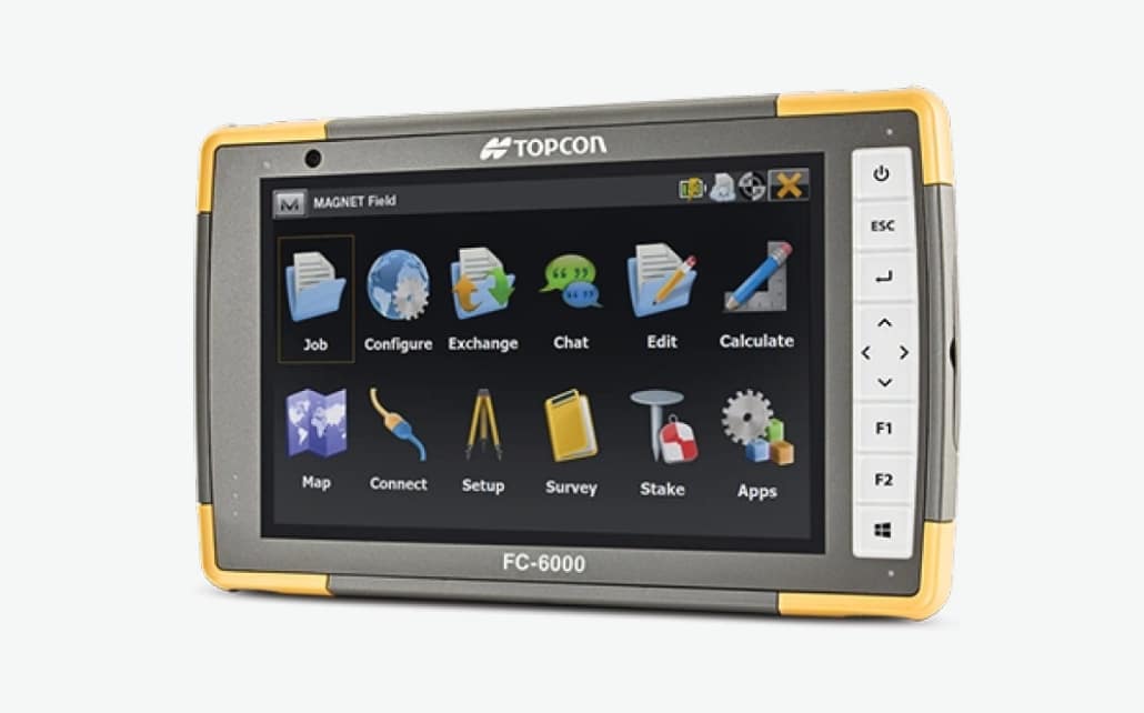
TOPCON MAGNET FIELD
FIELD AND OFFICE, CONNECTED

A Complete Field Solution For Geopositioning Professionals

Picture
MAGNET Field

​  Features And Benefits:
  • Intuitive user interface
  • Advanced roading tool set
  • Vast library of Import / Export file formats
  • Calculate, contour, and compare surfaces
  • Surface staking with automatic Digital Terrain Model creation
  • Colorized cut and fill indicators, as well as volume calculations
  • Direct connectivity to your private Company Account for easy data exchange and quick chat
  • Microsoft Bing Maps® for real-time images behind your points, lines, and imported design files
Full Field Connectivity
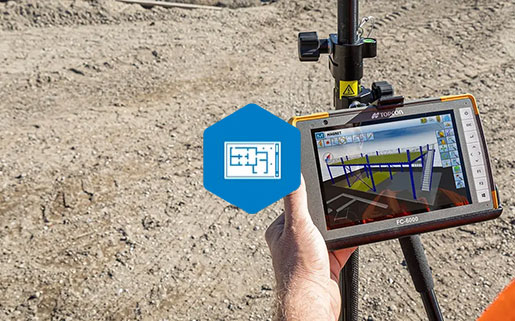
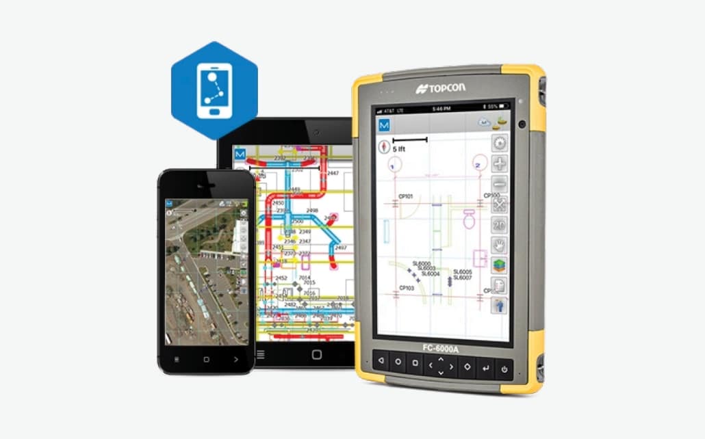
MAGNET Field is a powerful and intuitive field application software that enables you to collect survey mapping data and perform construction and road layout using total stations, levels, and GNSS receivers.

​MAGNET Field is easy to use. Perform topographic and layout operations with a supportive Microsoft Bing Maps satellite image background. Carry your custom CAD standards to the field with a single screen tap; the software will instantly draw three dimensional linework and symbols.
MAGNET Field Brochure
360 E. International Airport RD. Suite 10 Anchorage, AK 99518
Office (907)562-8000
                ​Fax (907)562-8080
                 
Picture
Picture
  • Home
  • Training & Updates
    • Training >
      • Veta Intelligent Compaction
      • MAGNET
      • Pocket 3D
    • Important Updates >
      • New Topcon Training and Support Site
      • MAGNET Version 4.0 Release
      • MAGNET Version 3.3 Release
      • MAGNET Version 3.2.1 Patch Release
      • MAGNET Version 3.2 Release
    • Testimonials
  • Contact
    • Location
    • Staff
  • Construction
    • Machine Automation
    • GPS Surveying Systems >
      • Recievers >
        • NEW HiPer HR
        • GR-5
        • HiPer SR
        • HiPer V
        • Hybrid Positioning
      • Antennas >
        • PG-S1
        • PL-S1
        • CR-G5
        • PN-A5
      • Radios >
        • SRL-35
        • SATTELLINE - EASy Pro
        • ADL Vantage 35
    • Field Controllers >
      • FC-5000
      • Tesla
      • FC-2600
      • FC-500
      • Allegro 2
      • Surveyor 2
    • Lasers, Levels & Theodolites >
      • General Construction Lasers >
        • RL-H4C
        • RL-VH4DR
        • RL-SV2S
      • Interior Lasers >
        • RL-VH4DR
      • Slope Lasers >
        • RL-200
        • RL-SV2S
      • Utility Lasers >
        • TP-L Series
      • Auto Levels >
        • DL Series
        • AT-B Series
      • Theodolites >
        • DT-200
    • Scales >
      • Wheel Loader Scale
      • Dumper Scale
      • Excavator Scale
      • Hook-Lift Truck Scale
      • Conveyor Belt Scale
      • Software Solutions
    • Return On Investment
  • Survey
    • GPS Surveying Systems >
      • Recievers >
        • NEW HiPer HR
        • GR-5
        • HiPer SR
        • HiPer V
        • Hybrid Positioning
      • Antennas >
        • PG-S1
        • PL-S1
        • CR-G5
        • PN-A5
      • Radios >
        • SRL-35
        • SATELLINE - EASy Pro
        • ADL Vantage 35
    • Field Controllers >
      • FC-5000
      • Tesla
      • FC-2600
      • FC-500
      • Allegro 2
      • Surveyor 2
    • Levels >
      • DL Series
      • AT-B Series
    • Total Stations & Theodolites >
      • NEW GT Series
      • PS Series
      • LN-100
      • IS-3 Series
      • DS Series
      • MS Series
      • Hybrid Positioning
      • OS Series
      • ES Series
      • GPT-3500
      • DT-200
  • Software
    • Construction Software >
      • Construction Field Software >
        • Pocket 3D
        • MAGNET Field Site
        • MAGNET Field Layout
        • TopNET Live
      • Construction Design & Planning >
        • DynaRoad
        • MAGNET Office Mass Haul
        • MAGNET Office Takeoff
        • MAGNET Office Site
        • MAGNET Office Site With Resurfacing
        • 3D Office
        • TopNET Live
      • Construction Management Software >
        • DynaRoad
        • SiteLink 3D
        • SiteLink 3D Enterprise
        • Tierra
        • TopNET Live
      • Enterprise Services & Subscriptions >
        • MAGNET Enterprise
        • SiteLink 3D Enterprise
        • Tierra
        • TopNET Live
    • Survey Software >
      • Geospatial Software >
        • MAGNET Enterprise
        • MAGNET Field
        • MAGNET Office Topo
        • MAGNET Office Tools
        • ImageMaster
        • SurvCE
        • TopNET Live
      • Enterprise Services & Subscriptions >
        • MAGNET Enterprise
        • Tierra
        • TopNET Live
    • Mass Data & Mapping Software >
      • MAGNET Enterprise
      • MAGNET Field GIS
      • eSoftware
      • ScanMaster
      • ImageMaster
      • MobileMaster
      • MAVinci Desktop
      • TopNET Live
    • Monitoring Software >
      • MSP Rapid Office
      • MSP Rapid On-Board
      • MSP Rapid Mobile
      • TopNET Live
  • TopNet Live
  • Topcon Enterprise
✕